Carn-men-ellis Kerbed Cairn – Notes from the 2021 Equinox
SW 3481 2602
Latitude: 50.075005N Longitude: 5.707763W
50°04’30.0″N 5°42’28.0″W
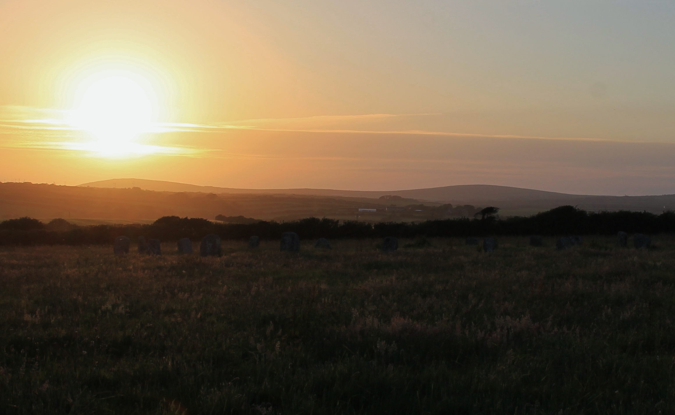
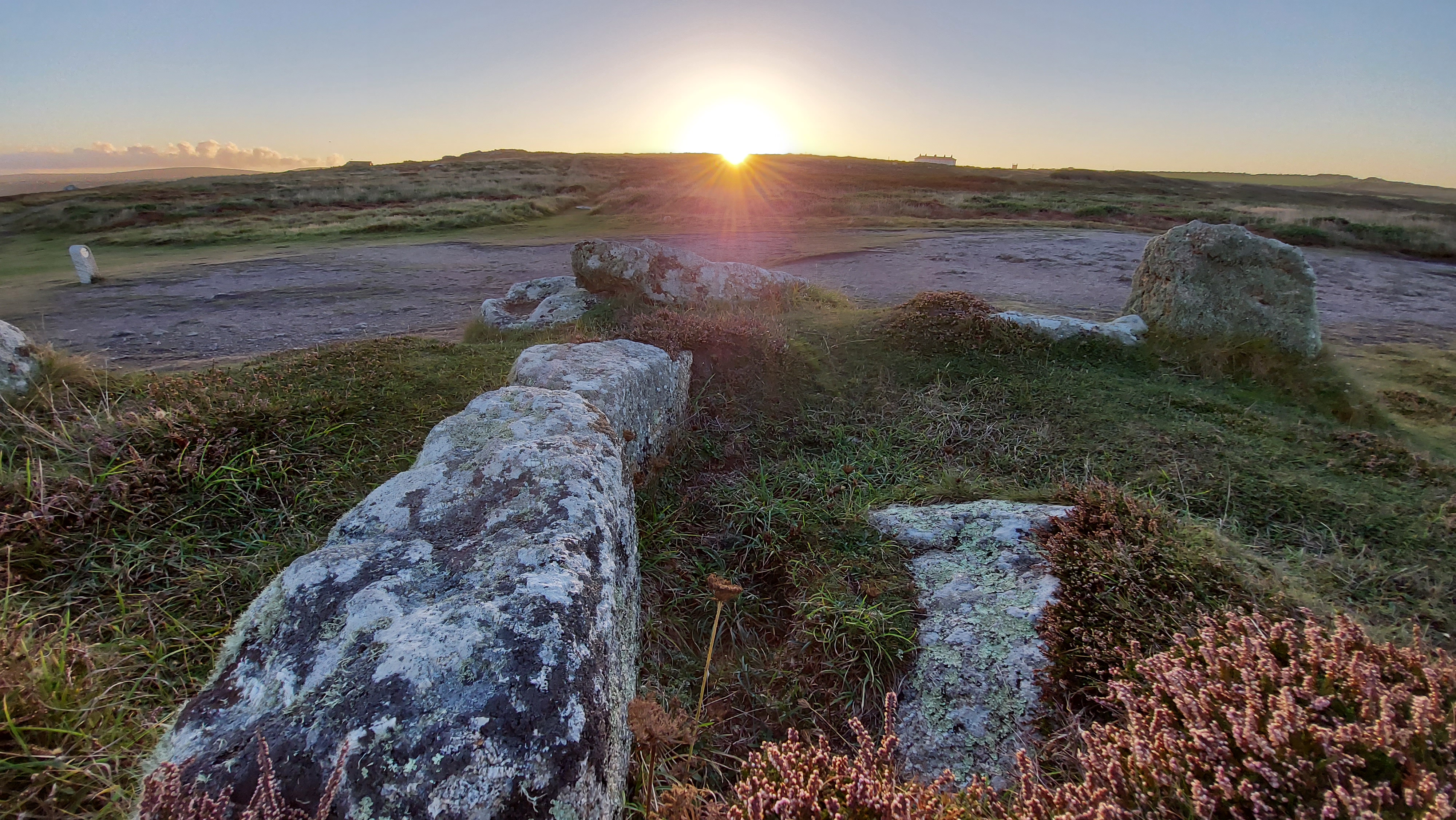
On the cliff top leading to Land’s End above Sennen are the remains of an intriguing prehistoric site known as Carn-men-ellis kerbed cairn (and cist).
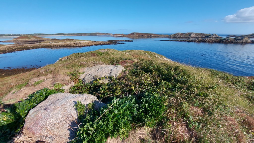
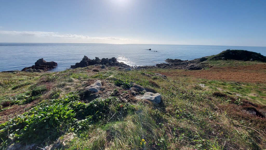
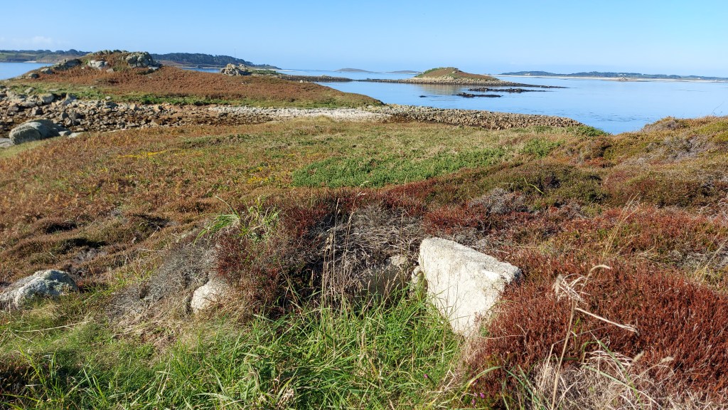
This monument is dramatically positioned overlooking the western edge of Cornwall, with Land’s End visible to the south and Cape Cornwall to the north. On clear days, the distant Isles of Scilly can be seen on the horizon. The site itself sits on a gentle slope descending from east to west. In the immediate vicinity are four cairns, including one particularly impressive example that stands prominently on the north-eastern skyline. To the south, on the headland, lies the later-built promontory fort known as Mayon Cliff Castle.
The monument has also been described as a Scillonian-style passage grave or chambered cairn, comparable to those at Tregeseal or Bosiliack. This one was excavated in 1879 by William Copeland Borlase, who recorded no finds. An early sketch of the site survives in the Morrab Library. The artist remains unknown, though it may have been commissioned by Borlase.
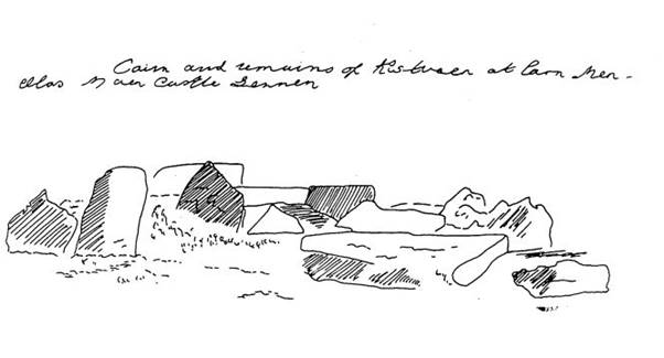
Sketched late 19th Century (Morrab Library, Misc. Pap. 44(1). Pl (17)). Possibly before Borlase excavated the site in 1879, as the dark shaded upright to the centre left was prostrate in later drawings, including a 1917 sketch by Charles Henderson below.
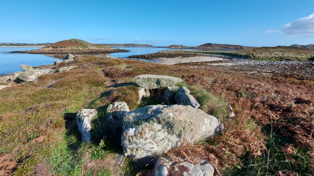
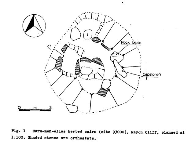
The grave was later sketched by Henderson in 1917 who labels a capstone and shows the kerb and central cist in plan form. A later assessment from the 1980s shows the moving of the capstone, an interesting stone with a rock basin and the remains of the central cist/passage area and kerb stones. This site is pretty much in the same condition as it was in that sketch.
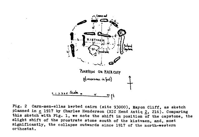
Carn-men-ellas kerbed cairn. Charles Henderson, 1917 (RIC Hend Antiq 2, 216).
In a 1983 survey report for the National Trust, Pete Herring suggested that the monument may have functioned as a territorial marker, a place where communities gathered for ceremonial events. A ritual or sacred centre where people gathered and sat with “their backs to the walls” of the chamber. (Barnett 1982, 49).
A rock basin is found on one of the stones; this would have formed by natural processes. Other rock basins have been incorporated into ancient sites. They may have signified ritual spaces as they could have been used perhaps for water collection, and maybe reflection of the face or sky, etc or adding other liquids like oil to light?. The Mȇn-an-Tol circular-shaped stone is an example of a rock basin utilised in a monument.
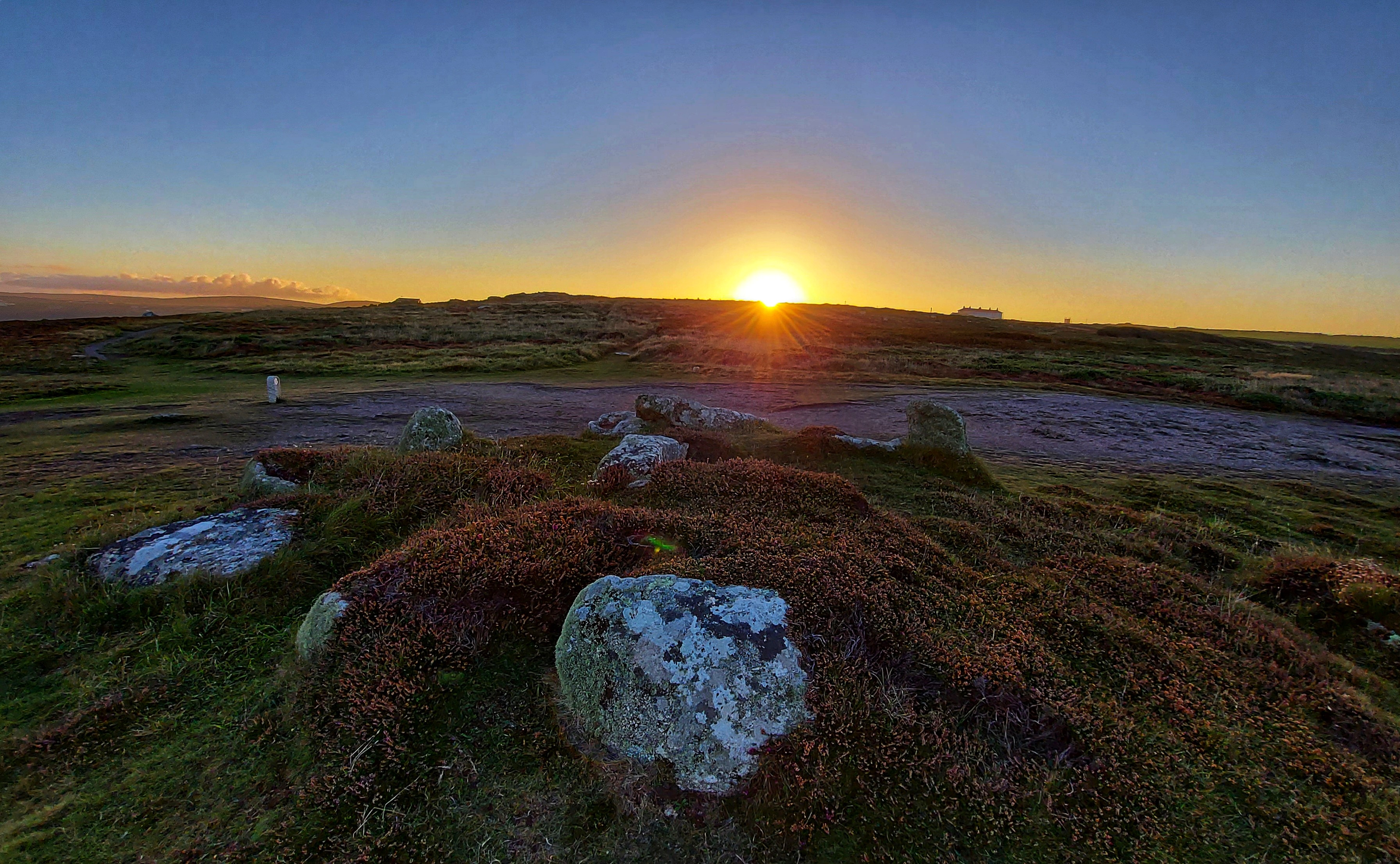
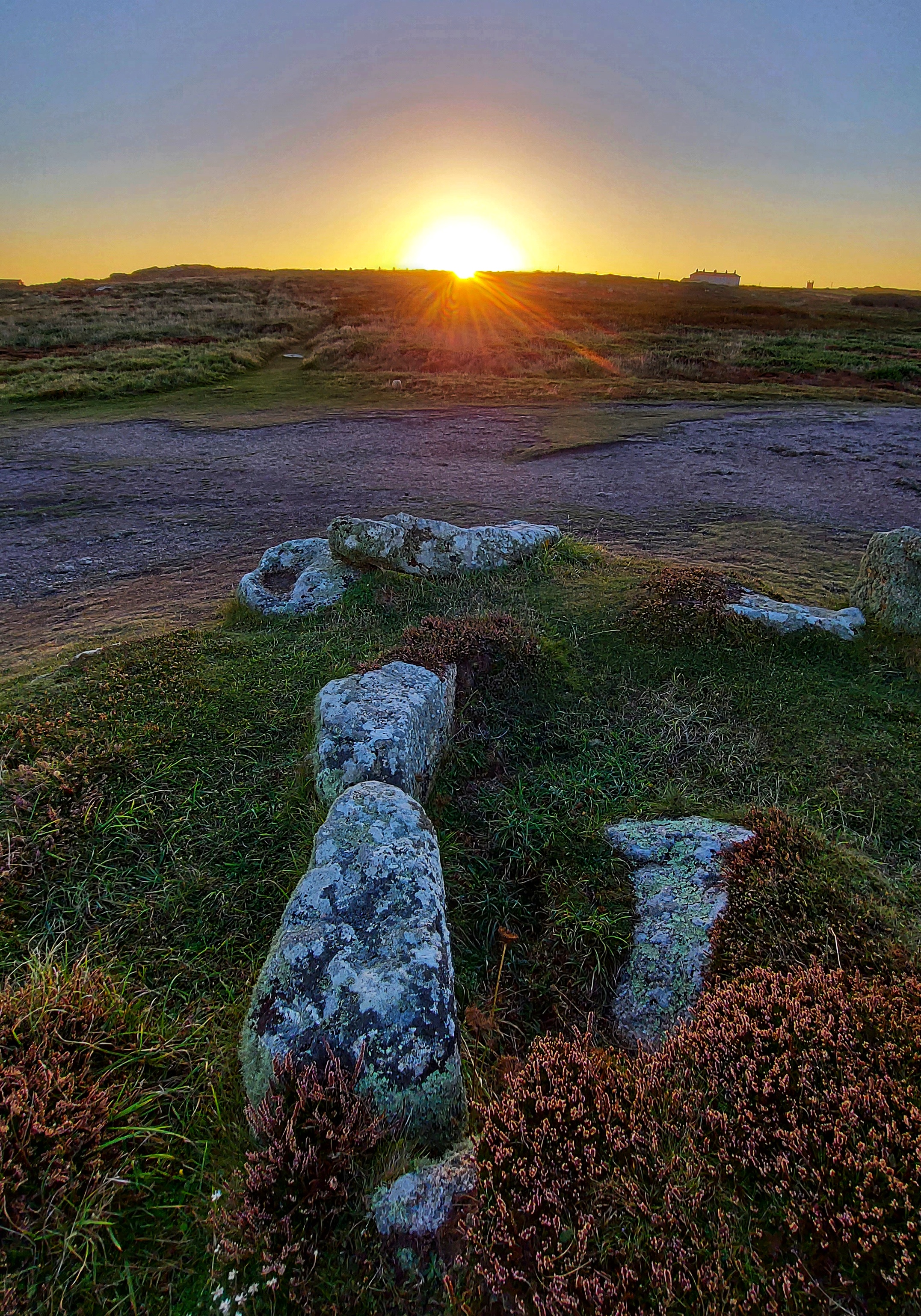
A personal visit to the site at dawn near an equinox revealed a possible alignment. The rising sun shines directly into what would have been the passage or chamber of the tomb as the back slab and chamber are oriented toward the eastern horizon. Two side stones, still in situ on the northern side of the chamber, appear to define a passage. One tapers southwards and may have restricted the light entering the chamber, like the arrangement at Treen South barrow.
This eastward orientation, which lets the sunlight enter the chamber at the equinox, is a feature shared with several other Scillonian passage tombs, as recorded by Katherine Sawyer and Paul Ashbee in their studies of sites on the Isles of Scilly. Ashbee observed that a significant number are aligned toward the eastern horizon, more so than in any other direction. Sawyer contended with 15% were facing E-W, out of 55, which could be accurately surveyed. Perhaps not an overwhelming picture of one direction proving more significant, although this was still the strongest favoured direction alongside the nearby facing ENE-WSW chambers making up 16%.
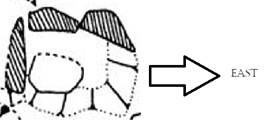
Back to this site both Henderson’s and the later CAU drawings show a site which is orientated to the eastern horizon, away from the western coastline and inland. The orientation of the chamber when it was measured was recorded at 90°.
At this location, the sun rose on the morning of the 20 September 2021 at 7.29 (BST) with an azimuth 91°56’43.3. It needed to reach an altitude of 3°07’50.2 to rise above the ridge of the local hill.
The images were taken 2 days adrift from the mid-point in the solar cycle.
Adjusting these two days to the mid-point (equinox), it would rise above the ridge at an azimuth of 93°09’38.3
A difference of 1°12’55.0 or a displacement of 2 solar widths to the south (to the right in image as shown below)
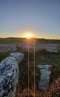
Visualisation of the displacement of the sun along the horizon, between the photo date and mid-point sun (equinox) date, as seen from the rear of the chamber.
With the limited amount of information we have about the entrance area and size/possibility of an entrance passage, we can only surmise that the sun would shine directly into the chamber area for at least 2 days, either side of the mid-day sun.
Solar rising and setting positions
Apart from the orientation of the barrow towards the eastern horizon and the mid-point rising sun. It is worth looking at its situation in the landscape with respect to the extremes of the solar cycle. Much of the horizon is distant seascapes. The Isles of Scilly make an appearance as and when conditions allow; they lie on the WSW at an orientation of 245-257°.
Only the sunrises at the solstice and the midpoint occur over land. Of these, the summer solstice sunrise is of interest as it occurs over the distant Bartinney Hill, which has an enclosure and cairns at its summit. This prominent hill has extensive views throughout the western part of Penwith. Also visible is Chapel Carn Brea. This is located just to the south west of Bartinney and can be seen in the photos adjacent to the localised ridgeline.
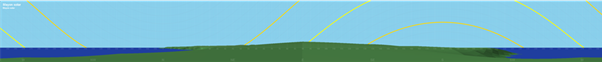
Horizon detailing the rising and setting positions of the sun at solstice and the mid-point.
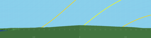
Section of Horizon showing eastern view
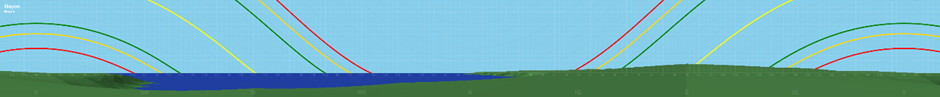
The yellow track is the solar position at mid-point and solstice, red and green tracks are the moon at standstill positions
Barnett, J (1982). Prehistoric Cornwall p49
Sawyer, K (2015). Isles of the Dead p59
Herring, P (1986) The National Trust Archaeological Survey, Maen Castle and Lands End p25