It seems fitting that I am posting this on Beltane, as it was one of Norman Lockyer’s favourite associations, which he explored, making connections between ancient sites and the sky (particularly in Cornwall) at this time of year.
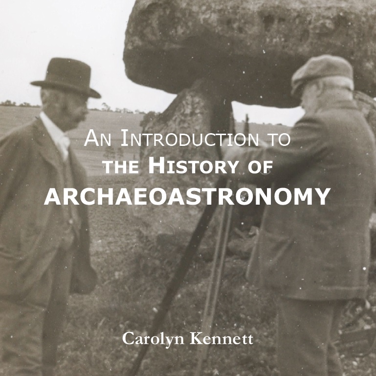
I have written this booklet as part of a series for the Society for the History of Astronomy. In it, I discuss Lockyer’s work alongside that of the many who came before and after him. Lockyer also features on the cover (many thanks to the Norman Lockyer Observatory for permission to use their image).
The booklet can be ordered through the Society for the History of Astronomy and costs £15, including postage and packaging within the UK. All proceeds go to this wonderful organisation, of which I am the current chair.
An Introduction to the History of Archaeoastronomy by Carolyn Kennett
For thousands of years, human civilisations have looked to the sky, recording the movements of the sun, stars, and planets in ancient texts. From the cuneiform tablets of Mesopotamia to the hieroglyphs of Egypt, references to celestial bodies abound.
Alongside these written records, numerous ancient structures across the globe appear to be aligned with the cardinal directions or with celestial events such as solstices and equinoxes. These structures—stone circles, burial mounds, and vast earthworks—are especially prominent throughout the United Kingdom and Ireland.
Unlike the civilisations of the ancient Near East and Mediterranean, we do not have written records to accompany many of these monuments. Their meanings have therefore been left to the investigations (and sometimes the imaginations) of those intrigued enough to study them.
Over time, scholars, archaeologists, and astronomers have examined these sites, proposing that many were designed with the movements of the heavens in mind. In doing so, they offer insights into how our ancestors may have understood and interacted with the cosmos.
This booklet traces the development of these interpretations—from their tentative beginnings to more systematic and scientific approaches. It explores the stories behind the theories, the people who proposed them, and the criticisms they faced, presenting a concise history of archaeoastronomy in Britain and Ireland as it developed into a multidisciplinary academic field.
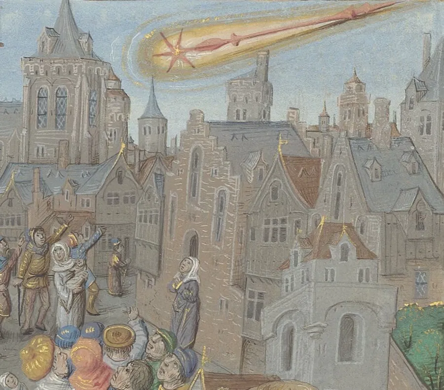
Recently, the astronomical community has been made aware of the discovery of several new comets, with one in particular poised to capture public attention: C/2025 A6 (Lemmon). This comet, discovered by the Mount Lemmon Survey in Arizona on 3 January 2025, is classified as non-periodic. Lemmon’s orbit brings it close to the Sun only once every 1,350 years, making this a truly rare event.
On 8 November 2025, the comet will reach its closest point to the Sun, known as perihelion, at a distance of just 0.53 astronomical units, or about 79 million kilometres. As comets approach the Sun, the increase in temperature causes their icy components to vaporise, resulting in the spectacular tails that are often visible from Earth.
I started reflecting on Lemmon’s previous visit, which occurred around the year 675 AD. The world at that time was vastly different: Europe was in the midst of the Early Middle Ages, the Byzantine Empire was flourishing under Constantine IV, and the Tang Dynasty was a centre of cultural and technological innovation in China. The Islamic Caliphate was advancing new ideas, and the Maya civilisation was constructing remarkable cities in Central America. It is intriguing to imagine that people living around 675 AD witnessed Lemmon’s passage, perhaps interpreting it as an omen or a sign from the heavens, as was common in many cultures.
The first comet recorded in the Anglo-Saxon Chronicles was in 678 AD, “HER ATEOWEDE COMETA AND SCAN III MON AS AELCE MORGEN SWlLCE SUNNE BEAM.” “In this year appeared the star called comet, in August, and shone for three months each morning like a sunbeam.”
Could this have been our comet Lemmon?
Determining whether C/2025 A6 (Lemmon) was a prominent feature in the night sky during its last visit is challenging. Comets with orbital periods over 1000 years can have extreme semimajor axes and eccentricity, and can fluctuate significantly in their orbital path. Also, the brightness of a comet depends on several factors, including its size, composition, and the amount of ice and dust it contains. Unfortunately, historical records from the 7th century are limited, so we cannot say with certainty how striking an appearance may have been. However, given its close approach to the Sun, it is plausible that Lemmon was a noticeable and memorable sight.
Whatever this comet was, it had a lasting effect on Saint Wilfrid of York, who was a powerful Northumbrian bishop in the seventh century who ruled a large number of monasteries. In the year 678, when the comet appeared, it was seen as a bad omen, and Bishop Wilfrid was driven from his bishopric after quarrelling with King Ecgfrith of Northumbria.
Happy comet hunting all
Also appears as Oct enews Chair Chat – Society for the History of Astronomy
Bibliothèque de l’Arsenal, Ms-5206 réserve, fol. 152r
In late 2019 I was part of a small group of enthusiastic scientists and historians who came together to discuss their love of Cornwall, the history of astronomy, old scientific instrumentation and the life and work of George Biddell Airy (1801–1892). As a group we were struck by one central aspect to our interests: his Cornish Dolcoath Mine Experiments of 1826 and 1828 to measure the density of the Earth. The discussion led us to devise a plan to get together in a Cornish mine to re-enact the experiment as close to the original as possible. It was an ambitious project and when we set off on this journey we could not foresee all the setbacks and delays that would hamper our efforts to reconstruct the experiment. There have been a number of times when it seemed an impossible task, but we kept moving forward, albeit in very slow increments at times and often with similar parallels that were faced by the original experiments. But before we reach the conclusion on our progress it is important to say a little about the experiment and the reasons why we are still determined to make this happen.
The Experiment The use of pendulums to measure the difference in gravity around the Earth was nothing new when George Biddell Airy and William Whewell set off to Cornwall in 1826. It had been known that the Earth’s gravity was variable since 1671 when the French scientist Jean Richer made measurements with a pendulum clock and discovered that gravity was not uniform and that it was running over 2 seconds slower in French Guiana than in Paris. In 1737 the French mathematician Pierre Bouguer swung pendulums at different elevations and from the rate of swing was able to make the first estimate of the density of the Earth. There was a lot of concern over the accuracy of these early experiments due to the difficulty in measuring the period of the pendulum. These concerns continued unabated until the invention in 1817 of a reversible pendulum by British Captain Henry Kater. The invention would offer the opportunity to measure the local acceleration of gravity with much more accuracy than ever before.
The experiment required the free-swinging pendulum to be hung in front of a tall grandfather-style precision clock and the timing of the swing would be measured against the clock-driven pendulum behind. To get a measurement for the gravity of the Earth you would need to run the experiment in two locations with different altitudes. Using mountains would be one option, but the mines of Cornwall offered another.
Dolcoath 1826 Dolcoath Mine in the early 1800s was the deepest mine in England. Known locally as The Queen of Cornish Mines it was located in the far west of England near Redruth. It was a very profitable working mine mainly extracting copper, but also tin, silver, arsenic and other minerals. By 1826 it was over 2000ft in depth, with its deepest recesses accessed by long series of ladders. Any equipment, mine spoil and occasionally men would travel up and down the large shafts in buckets called kibbles. The laborious activities would not be limited to the underground, on the surface were noisy pressing stamps and arsenic works which ran beside the engine house. These were working environments before the times of health and safety where accidents were frequent and life was hard for the men, women and children who made their living through mining.
The main way to get goods and occasionally people in and out of the mine – Riding the Kibble Credit: Mines and Miners. Louis Simonin, 1868 It was in this environment that the two scientists Airy and Whewell arrived first in the summer of 1826 and brought with them precious and expensive precision instrumentation to conduct a scientific experiment. What could possibly go wrong? Well, as it turned out, quite a lot! On arrival, two stations were set up, one underground and one on the surface (perpendicular above to the underground station). Two pendulums (named Foster and Hall after their previous owners) in the design of an invariable Kater one-second pendulum were suspended on knife edges and hung in position in front of a clock pendulum. Alongside the pendulums, they arrived with seven precious and valuable chronometers, tripods, telescope sights and tents.
The surface station was set up in a tent on top of a hill which rises to the south of Dolcoath mine while the subsurface location was 1200ft underground. The cavern in which it was located was split into two with a wooden screen. The experiment was placed behind one side of the screen and separated from the person who would watch the motion from the other side through a sighting telescope looking through a small hole in the screen.
Each pendulum swung for 6-8 hours a day while being watched by either Airy or Whewell, and then the timings were compared between the two stations. The chronometers were transported between both sites at the start and end of the experiment to compare with the clocks. There were some initial concerns. The stands were not up to the job as they were not stable enough. The fragility of the chronometers and lack of agreement between the timings of these was a major concern (two soon had broken glass, damaged from being carried up and down the ladders). It was decided to make the observation runs shorter – just 5 hours of observation a day – so they could compare the chronometers to the ‘clock’ more regularly with an ambition to lead to better accuracy.
After the first cycle of measurements was made there was an attempt to raise the Foster pendulum to the surface. At this point, there was an accident and the straw packing within the kibble caught fire and the bottom of the bucket burnt through. The pendulum plunged downwards and was lost to the abyss. Airy believed it was sabotage and certainly the miners could have been to blame. They were a suspicious lot, living in a remote part of the UK and working in a job where death was commonplace. The arrival of two scientists from London with their strange requests couldn’t have gone down well. At best they were seen as an inconvenience at worst they were regarded as the source of bad luck. Sedgewick encapsulates this in his accounts of the experiment “One morning I listened to two men who had watched our descent the day before: “I think they’re no good. There must be something wicked about them – the little one (that was Airy) especially. I saw him stand with his back to the Church, and make strange faces.” (Sedgewick, 1890)
Airy immortalised the moment of disaster in a poem The ladders of mighty Dolcoath I descended Through caverns that yawned like an entrance to hell:
All was silent, save when through the levels came blended The roar of the blast and the kibbul’s deep knell. To the right, a vile path round the South Shaft was bending: Behind, a chain-ladder from hooks was depending: Our station’s white door in the front was ascending: When I marked the sad spot where the pendulum fell. Dark and drear was the spot in Dolcoath’s deepest level Where the pendulum’s fragments were scattered around, As when, at the close of some drunken men’s revel, Broken bottles and plates encumber the ground Yet though scatter’d they lay, not entirely neglected: For the men who had packed them, with spirits dejected, And Mid Cattell and deads the small pieces selected, And sent up to grass all the bits that they found. Taken from George Biddell Airy, ‘Dolcoath’, in P. D. Hingley and T. C. Daniel (eds.), A far off vision: a Cornishman at Greenwich Observatory. ‘Auto-Biographical Notes’ by Edwin Dunkin, F.R.S., F.R.A.S., (1821-1898), with notes on the lives & work of his father, brother and son, (Royal Institution of Cornwall: Truro, 1999), p. 182.
Dolcoath 1828 After the ill-fated first attempt, Airy and Whewell would return in the summer of 1828. This time they arrived with reinforcements; the intention was to keep the experiment running twenty-four/seven. Accompanying them were the eminent astronomer Richard Sheepshanks and geologist Adam Sedgewick. They also had a number of additional helpers including Airy’s younger brother. In another change to the original experiment instead of bunking down in the local count house (now Miss Mollies Tea Rooms) they were to stay within the houses of local mine owners and aristocrats, the experiment had become in all ways something much grander. They arrived on site on the 8 July with two pendulums named Sabine and Brisbane after their previous owners and used the same setup as before except they had calculated that a one-second difference between chronometers was less significant over a longer period. So instead of 5-6 hour shifts, they would watch the pendulums continually with no breaks. There would be 3 people at the surface and 3 people below, they would work in shifts with shift work starting at 6am, 2pm and 10pm. Sheepshanks was in charge of the upper station while Airy was in charge of the lower station and he made sure he climbed the ladders to watch over every changeover: a gruelling schedule for himself while the experiment was in progress. But by the 10 August the observations started to show an issue, something which Sheepshanks would work upon, eventually showing that it was an issue with the knife edge and agate plate. The steel knife edges of Sabine were not accurate enough. When the two pendulums were hung back to back the error was obvious. Airy fixed and made adjustments accordingly. Once this was resolved the experiment started again in earnest and the main experiment ran between the 16–19 August, when it was abandoned due to rising water in a lower part of the mine which infringed on their area. Airy left the experiment running for as long as he could until even he had to admit defeat once more and return everything to the surface.
In total 127 hours of observations were made. From this, they were able to draw the conclusion that the lower station accelerated by 2 seconds a day. These early results must have been exciting to the team, unfortunately, the experiment was cut short again this time the mine had slippage and they had to come out of the lower levels, and the experiment closed.
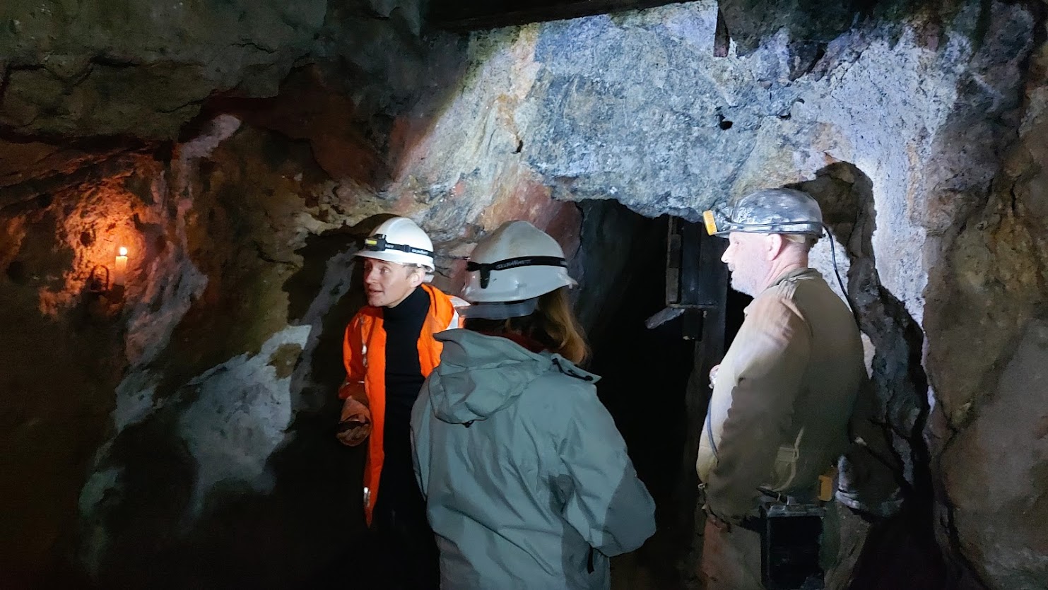
The Rosevale Reconstruction The first hurdle we had was finding a location in Cornwall where we could conduct the experiment. Dolcoath has been decommissioned and flooded with water, as have many of the deep mines within Cornwall. We were in luck when we identified Rosevale mine in Zennor; this was a working mine run by enthusiasts and ex miners and offered us the opportunity of access, albeit not to the depths that Airy would encounter at Dolcoath. A predominantly Victorian mine, access to levels is by ladders and there are wonderful features such as the original tools and candle wax running down the walls. Like all mines, it is the environment, which is prone to change, and 2020 saw our first hurdle as the mine had been shut due to covid restrictions. The pumps had stopped working and the lower levels flooded, making access an impossibility, so we turned our attention instead to the manufacture of the pendulum.
One of the mine’s core team is a clock repairer, maker, and member of the Royal Horological Society. This was key as Kater pendulums were once quite common but are now incredibly rare instruments. We could not take an original into the damp, dirty and dangerous environment of a mine and quickly identified that we would need to build one of our own, which could at worst take damage from transport in and out to its subsurface location. The making of the pendulum would require detailed information about materials, fixings, sizes and processes. We soon discovered that pendulums had been made from a number of different materials, brass, copper, wood and in some cases steel. Our investigations into exact measurements of the pendulums were equally elusive. This led us to the conclusion that we needed to see an original for ourselves. We found that one of these pendulums was housed at the Science Museum in London and after many delays due to covid restrictions one of our team Dr Daniel Belteki had the opportunity to photograph one in the late summer of 2021. This information has allowed Wayne Ridgeway the clockmaker to make a replica pendulum. A last-minute change at the end of December due to one of our team contracting covid saw us delaying the experiment until Spring 2022.
The Experiment On 9 April 2022 we finally got the opportunity to run the experiment. Wayne Ridgeway had completed his manufacture of a Katar Pendulum replica and he had acquired a regulator to be positioned behind. We had chosen a location in the mine which was not too wet or had too much of a draft. The temperature was cool around 11 degrees and we could see your breath in the air. Dr Edward Gillin, Dr Daniel Belteki and I waited patiently as Wayne positioned and started the regulator, before leaving it to settle. He then hung the free-swinging Katar pendulum a short distance in front.
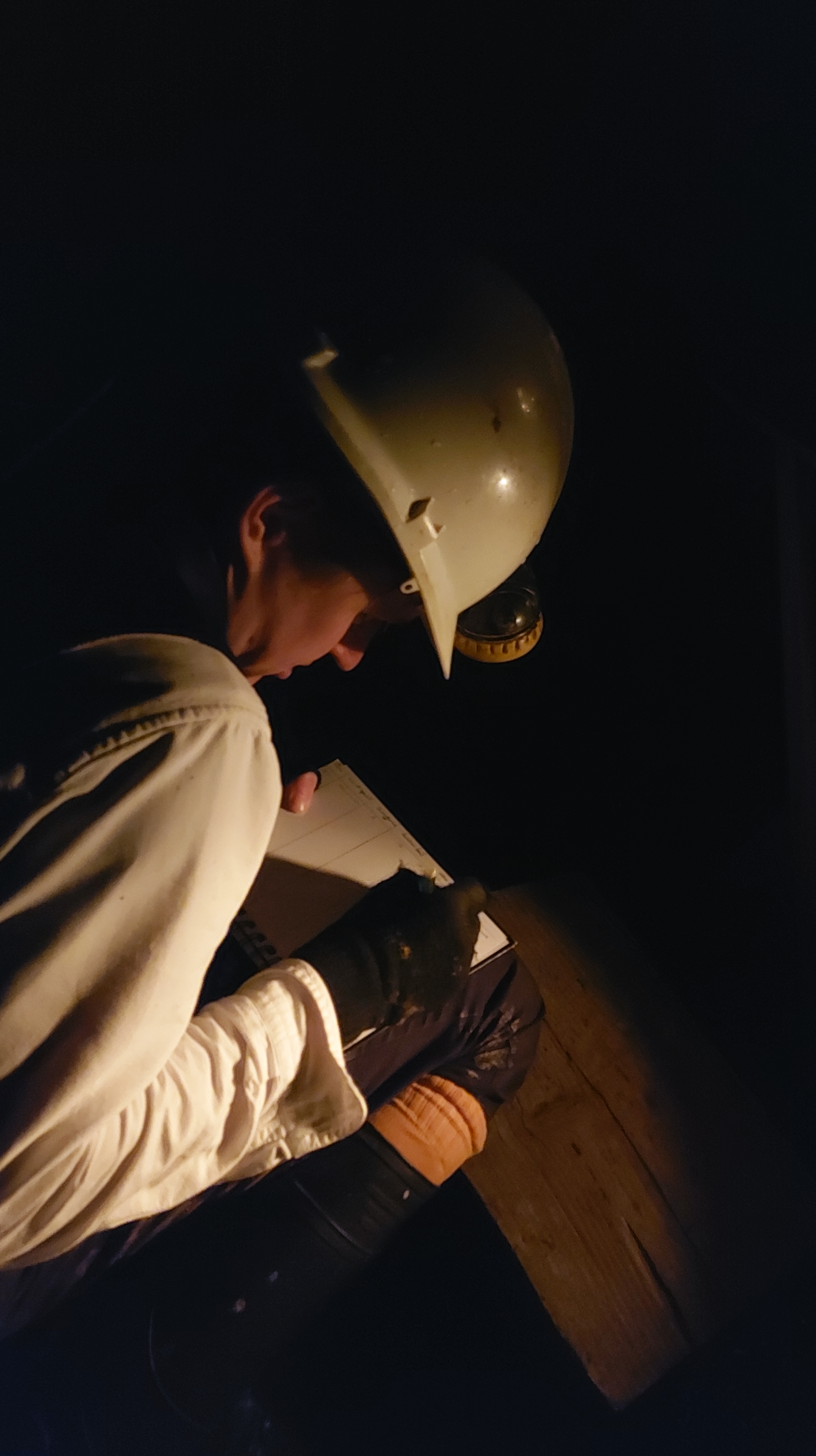
The regulator pendulum had a white dot upon it and the Katar pendulum had a black piece of wood which extended below the bob. It would be these two key elements that we would be watching during the course of the experiment. Positioning ourselves a short distance away we placed a small antique brass sighting scope on a table. Looking through this scope we would be watching for the moment that the white dot was ‘eclipsed’ by the black rod. In effect, it would disappear. This would be the timing that the two pendulums would be swinging together and the original experiments were called coincidences. We could anticipate when these would be forthcoming, as the pendulums visually started to look as though they were swinging in harmony, rather than in opposite directions. A coincidence deep in a mine would occur faster than one at the surface and it is this difference which would allow Airy and Whewell to undertake their calculations.
The first coincidence was witnessed by me. I found myself at the sighting scope just minutes before it was due to occur. It had been a challenge to focus on the pendulum through the small sighting scope, and I had felt a moment of panic when I thought that would be visually usable to undertake the measurement. A realisation that I had to use my peripheral vision, much in the way an astronomer would when teasing out detail on a planetary disc. I allowed my eyesight to settle and soon saw the inverted small image of the white dot and black rod through the sighting scope. As the first person to witness the event, it was very hard to know what to expect what I can claim to have seen is the eclipsing of the white dot, not once but twice, the first time for less than a second and then the second time for a longer period of 16 seconds. My experience was similar but unique to those that followed. Daniel Belteki made the observation of the second coincidence and he didn’t see a complete covering of the white dot, but he did see a maximum covering not once but twice, shortly spaced apart in time, Edward Gillin saw something similar when he had a go at the third coincidence.
Each coincidence was timed between 44 and 46 minutes apart and we felt this had more to do with the expertise of the instrument maker than the observers. With more time and coincidences I am sure we would have made improvements in the accuracy of the observations. It had taken a long time that morning to set up the equipment and get the regulator running smoothly. After nearly 5 hours of observations, we had to allow the mine to pack up and dismantle the experiment. Our limitations were very apparent, we had a lack of time to repeat the experiments to a similar length as Airy and Whewell (they conducted 127 hours in total), and we also lacked depth in which to conduct the experiment. Even so, this has whetted our appetite to try again and improve on our first attempt. We felt we were very successful in exploring the challenges involved in undertaking such an experiment in a less than ideal location and we are all looking forward to a time when we can reconvene and try it all over again. See also: George Biddell Airy, ‘Account of experiments made at Dolcoath Mine, in Cornwall, in 1826, & 1828 for the purpose of determining the density of the earth’, in P. D. Hingley and T. C. Daniel (eds.), A far-off vision: a Cornishman at Greenwich Observatory. ‘Auto-Biographical Notes’ by Edwin Dunkin, F.R.S., F.R.A.S., (1821-1898), with notes on the lives & work of his father, brother and son, (Royal Institution of Cornwall: Truro, 1999). Sedgwick (1890) quoted in, John Willis Clark and Thomas McKenny Hughes, The Life and Letters of the Reverend Adam Sedgwick, LL.D., D.C.L., F.R.S., Fellow of Trinity College, Cambridge, Prebendary of Norwich, Woodwardian Professor of Geology, 1818-1873, Vol. I of II, (Cambridge University Press: Cambridge, 1890), p. 332.
Please be aware that Goodaver Circle is on private land and permission must be sought before visiting it.
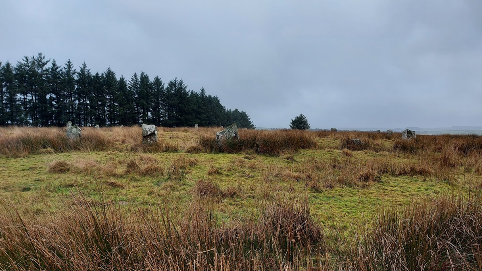
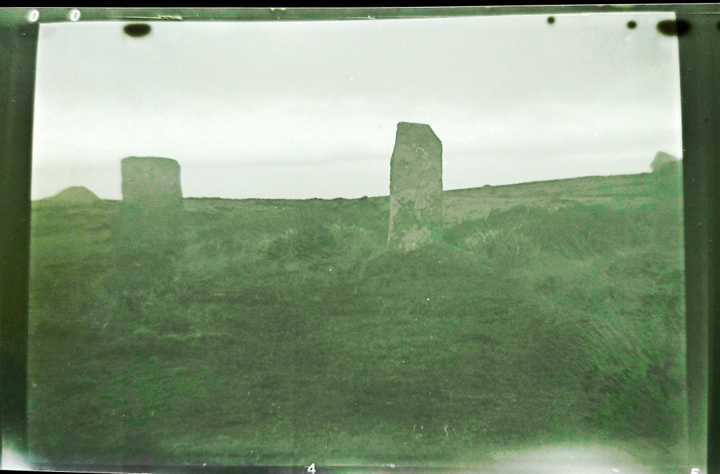
Within the digitised Stanley Opie collection of photographs at Penzance’s Morrab Library, three images bear the title “Unidentified stone circle. Possibly on Bodmin Moor.” These photos initially evoke the essence of a typical Bodmin Moor circle akin to the Stripple Stones, nestled in expansive moorland with panoramic vistas.
Stanley Opie, an archaeologist with a penchant for capturing historic sites and archaeological excavations in Cornwall, was born in Barncoose, Redruth, in 1884. Armed with an Ensign Cameo No. 2 camera and Imperial Eclipse plates, he documented these sites from 1930 to 1950. The Morrab Library in Penzance now houses its comprehensive collection, which has been meticulously digitized and is accessible online and through authorized visits. Throughout his career, Opie photographed numerous locations in Cornwall and beyond, presenting a formidable challenge in identifying the locales depicted in his images.
Closer scrutiny of the three images confirms their association with the Goodaver stone circle on Bodmin Moor. This revelation may surprise observers, as a contemporary visit to the site reveals a markedly different landscape. Presently surrounded by trees from a local plantation, the circle’s original context is obscured. However, this wooded enclosure provides a tantalizing glimpse into the potential positioning of the circle and its conceivable sightlines. Such insights allow us to speculate about astronomical alignments that may have held significance for the circle’s original builders.
In the current era, the entire site is enveloped by trees, except for a western view that descends to the farm and riverbed below. An opportunity arose to capture the site before aligning Opie’s photos with the landscape features, offering a unique perspective on the possible sightlines that the original builders may have considered when siting their circle, unobstructed by the present-day vegetation.
The Rabbit stone helped orientate the circle in the photos (to the left of the image
It helped that there were several unusually shaped stones. One in particular got named the rabbit stone after having a similar profile of the Lindt rabbit, it can be seen on the left of this image. (I should say at this stage that the circle was heavily restored in 1906 and some of the stones are thought to have been replaced incorrectly, even upside down).
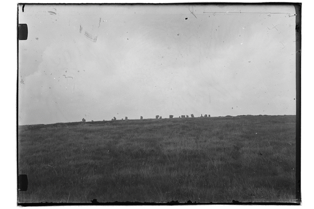
Opie Photograph no 1
This image took a bit of matching. The two central blocky-looking stones and the rabbit-shaped stone on the right of the image helped orientate it. In my image below the rabbit, the stone is also to the right and slightly obscured by the rocks in front of it.
The rise in the ground beyond the circle is Brown Gelly, which is towards the southwest. This Tor is obscured by the trees on the left of the more recent image. The area has several interesting ancient sites on it including some Cairns on the top, which can be seen on the ridgeline of the image. There can be no solar or lunar alignment with these local cairns as they are too far to the south when standing within the circle.
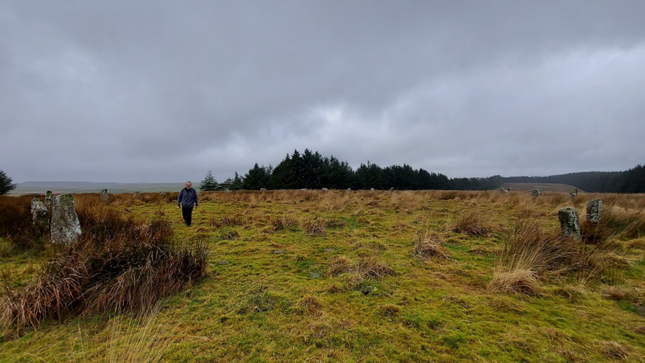
This second image gives a more expansive view looking out from the circle to several ridgeways and hills beyond.
Looking at the stones in the image, the tall pointy stone and gap next to the man at the front of the circle helped orientate the image, as did the rabbit-shaped stone behind him. The image looks from the south of the circle facing north.
The hill towards the centre-left of the image is Leskernick, Bronn Wennili (Brown Willy) may be visible to the left of the image. This is exciting as it means that standing in the circle you could have seen the summer solstice sunset over the distant hill. This is an extension of the line which starts at the newly discovered menhir on the ridge above the Hurlers Circle, extends through Craddock Moor Circle and the avenue at Craddock Moor, and onwards to Goodaver Circle. Making it possible to see the same summer solstice sunset at important prehistoric locations across the moor.
Continuing to the centre-right of the image is the local plantation ridge. Fox Tor which is relatively local to the circle would have been to the right of the image.
The pointed stone that the man is standing beside in the Opie image is front left in the recent one. My image is orientated slightly differently from the old image. It would have been pointing directly down the field to the right of the modern image. Looking down the neighbouring field in recent times there is no possibility of seeing what hills lay beyond.
The Opie photo shows stones in profile against the sky above with no plantation beyond, the rabbit-shaped stone is in the front row of the circle on the central left. Matching it to my photos of the circle, it has been taken from the northwestern side of the circle down the ridge a little way. Kilmar Tor would have been visible if the photo had been taken with slightly increased elevation. This Tor is directly east from the circle and in the position of the rising sun at the equinox (midpoint between the solstices). The modern photo has been taken from higher up the hill and the craggy tops of Kilmar Tor can still be seen through the gaps made by the less dense boundary of trees.
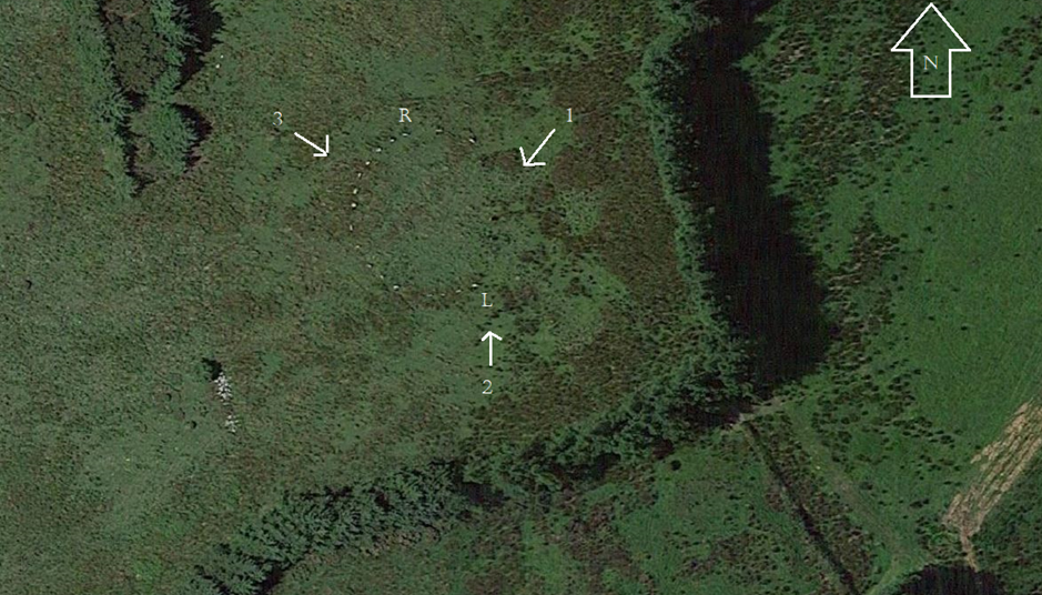
A plan of the matched direction of the photographs taken by Opie numbered 1-3
From matching the photographs old to modern I was able to make a plan of the directions which the Opie images were taken: The plan below is as follows:
R = Rabbit stone
L = taller long stone
Credit: Annotated Google Maps image
Finally, I should add that within the Opie photographs, none were taken in the direction of Hawks Tor in the west. This has been identified by Cheryl Straffon and John Barnett as an equinox setting position when standing in the circle. When visiting the circle in more recent times the Tor can still be seen in the gap made by the plantation to the west and is the one remaining solar alignment that could be viewed in action. Maybe one day the larger plantation trees will be replaced with smaller saplings and make the other viewpoints possible.
Access to the Stanley Opie collection and all the other wonderful historic digitalised images that the library has can be made here:
The importance of the Sun has been recognised throughout history. This luminous body defined the lives of people it shone on and the clocklike regularity of its rise and the set was well understood by humanity. Due to its significance symbolic representation of the Sun stretches far back into prehistory. Designs including the Sun weren’t uncommon and by the Bronze Age examples of solar symbolism are found across a range of mediums. Drawings and designs were often abstract in nature. Representation included circles, waves and cross shapes. The cruciform shape in particular has been linked to the Sun by Mary Cahill (2015) and her work on Irish Sun discs. These are flat circular objects made of gold, designed to shine brightly when sunlight radiates onto them. The etching of a cross on the surface shows the rays of the Sun in a conceptual way, maybe representing various solar events such as; Sundogs, pillars, rays and halos. Although no Sun discs have been found in Cornwall, these golden objects have also been linked to the lunula. A lunula was found with a pair of Sun discs in Coggalbeg, Co Roscommon, confirming an association. Furthermore designs on lunula lend themselves to observation with sunlight. There are examples of lunula found here in Cornwall and if you get the chance it is worth visiting the Penlee House Gallery where the Penwith Lunula is on display.
Sun discs with cross-shaped designs were found at Tedavnet, Co. Monaghan Ireland. Image Credit: The British Museum.
Other objects discovered in Cornwall from this period incorporate a cross design. Although perhaps not as glamorous as a golden disc, local urns can include a similar decoration. Trevisker style urns are a design of urn which are predominantly found in the South West of the UK. Dating from the Bronze Age the style is known for its hash/dash and zig-zag lines and use of local materials such as gabbroic clay from the Lizard peninsular. On occasion, the urns have a cross or cruciform design within the interior of the base. This seems to be a rare occurrence but there have been examples of cross based urns found at the Trevisker village excavation, Boleigh barrow, Tregeseal chambered tomb and an example from further afield in Kent. This final example was placed in a ring ditch, and the soot recovered from inside the Urn was radio carbon-dated to 1600-1320 cal BC. It was found shattered into over 200 pieces but was reconstructed, with its internally crossed base being clearly observable. The urn from the Tregeseal chambered tomb was recovered by William Copeland Borlase in 1879. Found at the end of the passage, in a separate area, it was recovered almost complete by Borlase during his excavation. It now resides within the British Museum. Tregeseal Chambered tomb is part of a group of Bronze Age entrance graves in Penwith which include Bosiliack, Tregiffian and Pennance. As an aside radiocarbon dating results on a burial at Bosiliack gave 1690-1510 cal BC (Jones, A and Thomas, C. 2010) a similar date to the urn found in Kent. The Tregeseal urn is a large example and is 21 inches in height. The Cross shape was meticulously drawn in plan form at the time. The plan was reproduced in the London Illustrated Times and it can also be seen on the wall of the Penlee House Gallery Museum in Penzance.
Trevisker Urn from Tregeseal. Image Credit British Museum Collection Online. The cross itself would not be integral to the structure of the urn. There seems to be no practical explanation as to why an urn of this size would have this addition in the base. It is therefore interesting to consider if some Trevisker urns could be following the tradition of Sun discs and offer a design that is indicative of solar symbolism? One aspect which strengthens the case of this idea is that the Urn would have started as a disc shape on which the cross shape would be added. Then the sides would have been added to the urn creating the final vessel. Looking down from the mouth of the urn it would have clearly taken on representation of the Sun in a similar way to the Sun disc design. An alternative explanation has been offered by Kavanagh, R (1973) who suggested that the cross was added to demonstrate a bottom of a basket and was a nod to the basketry traditions of the period.
The Tregeseal Urn base – in plan. Image credit: Report by W.C Borlase circa 1879
The Tregeseal example was discovered within the tomb base up, containing cremated remains. So the cross would have been above the remains. This could have been intentional. Many funerary urns are found base up. A cross at the top could represent a number of ideas. A Sun in the dark? A route to the heavens? A set Sun? There was just one time of the year which the Sun would shine down the chamber to its rear. This was the winter solstice sunrise. A recent survey undertaken by Carolyn Kennett and Grenville Prowse supervised by Penwith Landscape Partnership archaeologist Jeanette Radcliffe found the passage to be orientated at 128degrees. This orientation towards the solar extreme of winter solstice sunrise is in common with local tombs at Bosiliack and Pennance. On this day the sunlight would shine down the passageway hitting the back upright stone at the rear. The urn was positioned behind this back stone in a separate area or cist. Although currently it is difficult to understand the full design of the tomb, as this rear section has been removed and our understanding is reliant on the original plan from the Borlase excavation. It is also worth considering if the positioning of the urn in a separate section was intentional? This position would ensure that no natural sunlight would reach the urn at any time. The symbolism may have shown that it was providing its own light, even on this important day of renewal in the solar calendar. A photograph taken by Gibson and Sons at the time of the excavation shows a possible blocking stone at the start of the passageway, which would have further limited light down the passage on the solstice. There is no evidence remaining of this stone now, so it is difficult to understand the overall effect this would have had on limiting light at the solstice. It is worth remembering that the final resting place of this urn probably came after a life of servitude. The urn in Kent had traces of animal fats within it and was probably used as a transportation vessel for food before its final role as a funerary urn. Trevisker style urns are not the only vessels to include crosses on their base. Although in general this cruciform addition to urns is rare and seems to be reserved for the more decorative funerary examples. Other examples of cross based urns have been found in Ireland, Scotland and Yorkshire. As a final thought, I doubt we shall ever know the full truth behind this oddity in the design, but it is a nice idea to consider that the cross was added by our ancestors to bring light to the darkest of places.
Cahill, M. (2015) Here comes the Sun – Solar symbolism in Early Bronze Age Ireland. Archaeology Ireland 29(1), 26-33,, 2015.
Jones, A and Thomas, C (2010) Bosiliack and a reconsideration of Entrance Graves. Proceedings of the Prehistoric Society. 76, 2010, pp 271-296.
Kavanagh, R (1973) The Encrusted Urn in Ireland, Proceedings of the Royal Irish Academy: Archaeology, Culture, History, Literature, Vol. 73 (1973), pp. 507-617
Winter Solstice is the day we mark the longest hours of darkness and the movement towards the lengthening of daylight hours once more. For many it is a powerful time in their calendar, a day to mark the start of a new year, to reflect on what they can leave behind and look forward to the time ahead. There are a number of ancient sites within Cornwall that have links to the Solstice and many of these suggest a relationship that our ancestors had with this moment within their in their lives. Connectivity that we feel resonating through the ages and is particularly heightened at times such as this one.
This year a small group of us decided to join the ancient pathway the Tinners Way to the north of Zennor and walk to the Tregeseal stone circle. A walk which we would start in the half-light before sunrise and end after we had watched the sunset at the stone circle. Anyone who knows me will hear me talk about my love of the wider Tregeseal landscape and how I believe it lends itself to a winter solstice gathering; where people can watch the sunset over the distant Isles of Scilly. The whole of Penwith is rich with prehistory, and a large number of the sites are along the Tinners Way and the direction of travel we would be moving in would take us towards the southwest and the setting sun. An imaginary line could be drawn through the monuments we were to visit and a number of them, if you had stopped there, would have the setting winter sun at another monument further along our journey, making a long winter solstice line of running down the spine of Penwith hills and part of this journey for me is to see how far people could process through the landscape, on the shortest day of the year, with a final destination in mind.
I am very interested in the ideas around processional journeys and movement through the landscape, particularly ones which would connect people to the ideas of cosmologies and be started in the time of dawn and end after sundown. I hoped the small group who joined me that day were also in the same mind. This was also a time for us to take a moment out of the daily grind and reflect on what we wanted to leave behind and how we would move forward, with mindfulness, into the next year of our lives. Walking has become a really important part of my life and during the last two years of upheaval and turmoil, I have come to appreciate the quiet and reflective time I can enjoy when out in the landscape, but it is always wonderful to be joined on an adventure especially a journey of such length, which would require both fortitude and endurance.
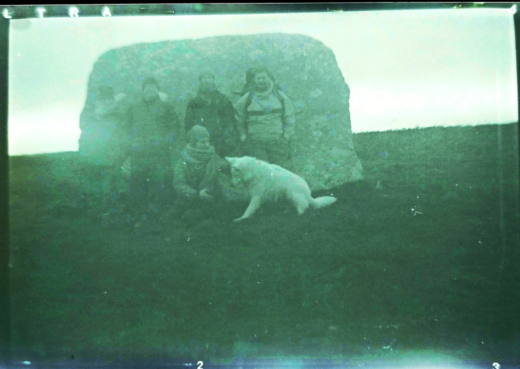
We met in Zennor just before dawn and the sky was in the main overcast, the clouds pink with the nearing sunrise. The Moon, which had been full two days prior, was still in the sky in the northwest, bringing an added element of light. Starting our journey we travelled up Rosevale valley, stopping to gather our thoughts for the day in the old and ruined miners cottage by the riverbed. It was commented on how we were a group of seven, six humans and a white wolf and in that moment of time it all felt a little otherworldly, like the start of a plagiarised fantasy tale., we all laughed at the sentiment and with the sunrise, we started on our way. Mulfra Quoit was a couple of miles away and we had to initially join the Tinners way, reaching it at the roadside near where the once impressive Tol Creeg passage grave had been destroyed and then removed in the 1960s. looking behind us we could see Zennor Quoit standing proud on the ridgeway and we got out first view of the southern coastline looking down the valley to the bay and St Michaels Mount.
The first hill of the day was in front, with Mulfa standing prominent on the top. We had settled into a nice pace at this point and think we were all excited about reaching our first ancient site of the day, one of many more to come. We had dropped into a rhythm of walking in pairs with the white wolf running back and forth between us covering triple the distance we were.
My 100 year old Box Brownie makes an appearance
Mulfra was an opportunity to take a morning break. We huddled inside the quoit listening to the wind rip around outside. We marked the occasion with songs, poems and blessings while thinking about the journey ahead. We had a decision to make, would we continue along the Tinners or drop through Bodrifty courtyard house village and head towards Ding Dong mine, which would enable us to walk the processional route past Nine Maidens, we chose the latter. Walking down the hill to Bodrifty courtyard house village proved interesting, the white wolf, who often chose to be in front, stopped short and started to howl, spooked by something we could not see, but it nevertheless brought us all up short with notions of ancestors, meaning and what the animal could sense that we couldn’t. I must admit I really like Bodrifty, I often spend time here in the summer and as ancient sites go, I always find it peaceful, and have never had a sense of anything foreboding at the site, neither had anyone else when we discussed it, but its amazing how common ancient sites invoke feelings that we cannot explain, that connectivity with the past runs deep through us all and visiting some sites can have profound effects on peoples emotions and sense of being. With some convincing, the animal seemed to move beyond what had been bothering it and started to visit the ruined huts alongside us all. As we explored the sun started to send shafts of light onto the southern coastline and even at the distance we were from it, we could see part of the ocean shining golden. A promise of what was to come and a brightening of the skies ahead.
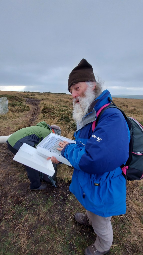
On reaching the path to Ding Dong we swung our journey to face to the north and started to walk the pathway to Nine Maidens on the top of Boskednan moor. Taking a moment to stop at the barrow we faced the impressive rocky outcrop of Carn Galva and took a moment to reflect on the people past doing the same of what we were about to today. This ridgeway is lined with barrows on both sides and by moving along it towards Carn Galver you really are walking in the footsteps of the many who have come before. I thought about the people who had built the monuments, those that had excavated them in the Victorian people (bless William Copeland Borlase and his dodgy excavation techniques :)) and the people who still come here today. The circle itself was a natural place to stop and talk about the Moon. If you are able to return here in 2025, the standstill year, you will see the moon set over Carn Galva. I would recommend heading to see the bright winter full Moon which will set over the rocky outcrop. This is a possible reason for them positioning the stone circle as they did. From here we could see the hills which we would be approaching later in our walk, those of Chûn and Kenidjack. We could also see the marker Boswen’s Menhir, which has been positioned in the winter solstice sunset position from the circle.
Box brownie image
This seemed like a good spot for a break for lunch, the ridgeway is exposed we headed for the ring cairn and its large triangular stone., where we chatted and watched the sun emerge from behind the clouds for the first time that day.
Rested up we headed down the hill to Mên Scryfa, an inscribed stone which was recommissioned in the early medieval period, originally, most likely, being a much earlier menhir. the inscription reads Royal Raven and could mark the resting place of Bran, Welsh King who had been hiding out at Caer Bran before being attacked and chased to his death at this spot. I like to think there is treasure underneath but maybe treasure from the Bronze Age, a Trevisker Style Urn with cremated remains in, rather than a king from the dark ages. The Mên-an-Tol was one of the first times we met people, others out marking the solstice day, a number of us took the opportunity to wiggle through the holed stone, the lack of water at its base made it a more present prospect than usual.
Fun at the holed stone
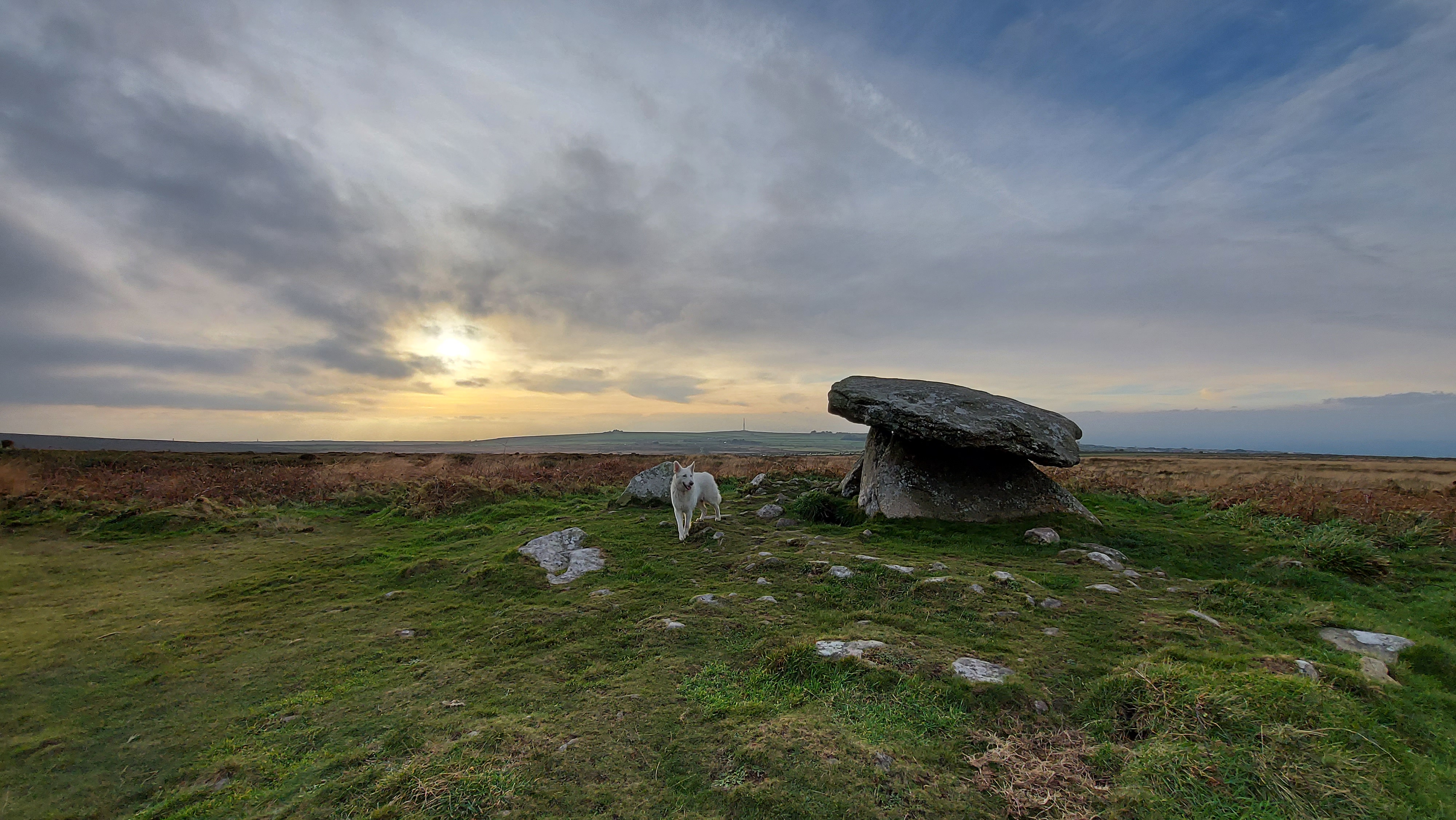
Once more we had a decision. we could head towards Chûn from here, but as we had time we decided to zigzag and include Bosiliack and Lanyon on our journey and I am so pleased we made that choice. A number of the group had never been to Bosiliack Scillonian style passage grave before and the adjoining Bronze Age village. This is such an impressive monument, perhaps even more so since it wasn’t known about until the 1980s when a gorse fire uncovered it from the undergrowth. The excavation revealed so much about the tomb, and it contained cremated remains from the Bronze Age, along with a much later dated skeleton. The tomb felt important to me to visit on this day, as it is orientated towards the sunrise at this time, and I have photographed it myself in a previous year. I doubt anyone would have been able to watch from inside, but it shows how as a community that wanted to mark this day and maybe bring light to their own ancestors who were buried within the tomb.
It had been a long time since I had approached Lanyon Quoit from this direction and although viewed from nearly everywhere else it sits within the landscape, this is one direction where it stands proud on the horizon, impressively towering up above everything around it. This quoit is interesting in that it was rebuilt after falling over and is not necessarily how the original designers, back in the neolithic imagined it.
From here we started to see the sun break through the clouds with more regularity, it was arching low in the sky and we realised that although we had a fair way to travel, the sun was well past the mid part of the day, time for us all to move on again.
The next stretch was longer again and we approached Chûn Castle from the farm in the dip. The wind was howling and we didn’t hang around too long in the Iron Age hill fort before we headed down the hillside to the neolithic quoit of Chûn. Unlike Lanyon this quoit is in fantastic condition, which says a lot about our ancestors. The people who came millennia later in the Iron Age and built the hill fort must have held some beliefs about the monument, as they left it intact on the hillside and did not rob the stone from their grand hilltop fortress. The quoit’s capstone is heavily decorated with cup marks and there is still room to wiggle inside, which is fun. Standing here for sunset you would see the sun dip behind Carn Kenidjack and a number of people were already making their way up the hillside, in the opposite direction to us watch the sunset from this location as we headed down the hillside to Tregeseal.
I had wondered if our small group were rocked out!! But they were still keen to see as much as we could and we stopped at Portherras cist and after much chatter all day we decided we would walk the next section to the inscribed stone in quiet, giving us a time to reflect on the journey we had made already and the time ahead at the stone circle. As we walked in the direction the sun was already dropping fast and low in the sky. This was a moment I think we will all cherish from the walk, as a group we can often lose the quiet purpose behind our decision to make the journey.
The inscribed stone was very apt, most likely a Christianised menhir this stones inscription reads TAETVERA. This is Latinised 7th century Cornish: Taithuere, or “exalter of the journey”. I have read that St Just himself could be buried here, once more I like to think that if anyone was then it is most likely an urn of Bronze Age cremated remains underneath the cairn at its base.
As we reached the holed stones it was incredible to see the low golden sunlight come along the row of stones, making shadows along the line of them. I love these holed stones and feel they have a really important role to play on the wider Tregeseal landscape, I reflected how long it must have taken for people to have made the holes and how they could have been used to mark the days, through the shadows and beams of light shining through the holes, possibly at this time of year. As we sat watching the sun from this location I checked my watch and the sun passed the actual moment of solstice. The time when the sun is directly above the Tropic of Capricorn. The sunset was also fast approaching and we needed to move to the circle below to watch it.
Tregeseal is such a special landscape to watch the winter solstice sunset from. A lot has changed since the circle was built. Originally another circle stood next to this one, and the huge hedge to the south was not put in place until the mid 20th century. Nevertheless, you can get a small sense of what it was like for people who made the journey to this site to watch the sunset on the solstice. There is a small glimpse of the sea, and on this sea gap on a clear day you can see the distant Isles of Scilly and it is on these islands that the sun will set. Suggesting connectivity which we can see reflected in shared monuments and material goods between the islands and mainland. At this moment more people came to add to our group and we celebrated the closing of one chapter and moved into the next with the setting of the sun on the shortest day of the year.
With weary legs and tired feet we had one more hill to climb back to our transport, we made this in the gloom of dusk; the night was fast approaching and by the time we reached the end, reflected sunlight could be seen on Venus and Jupiter. A reminder that sunlight was ever-present even in the darkest of times
I want to thank everyone who joined me on this walk and I am so pleased the weather was much improved to last years, Lanomrna Gap to Tregeseal.
We will be back next year with another walk, so if you are mad enough to want to join a hardy but fun bunch of people on a full day winter solstice walk let me know.
At Tregeseal stone circle
Places visited
Mulfra Quoit, Bodrifty courtyard house village, Nine Maidens stone circle, Nine Maidens barrows, Ring Cairn, Mên Scryfa, Mên-an-tol, Bosiliack passage grave, Bosiliack bronze age village, Lanyon Quoit, Chûn Castle, Chûn Quoit, Portharras barrow cist, Inscribed Menhir, Kenidjack Stone row, Tregeseal barrows, Tregeseal stone circle
Two excellent telescopes, belonging to the observatories of the late Mr Smeaton at Austhorpe, near Leeds, one of them an equatorial and the other a Transit Instrument. A purchaser may have the opportunity of seeing the manner in which the telescopes are fixed and the constructions to the observatories to which they belong and be furnished with any part of the materials if required, towards refixing them in the same manner. Also two remarkably good time pieces, belonging to the said observatories. Also a small fire engine with a ten inch cylinder calculated for supplying any gentleman’s house with water.
The telescopes and time pieces will be removed to London, if not disposed of by the first of April.
This advert was placed in the Leeds Intelligencer Monday 25th Feb 1793.
It was while searching through old papers looking for references to telescopes I came across this advert placed in 1793. Looking into this further I found a story of a man whom was one of the first amateur astronomers. This advert was selling on his death a large observatory and its equipment which had been placed in his garden at Austhorpe near Leeds in Yorkshire.
The man’s name was John Smeaton. And if that is a recognisable name that is because this man was a celebrated 18th century civil engineer. He is known as the father of civil engineering and even possibly even coined the name engineer. A Yorkshire man whom lived from 1724 – 1792. A man whom moved in intellectual and scientific circles he was a member of the Lunar society.
During his day job he built the iconic Eddystone lighthouse, (now seen on the Plymouth Hoe) numerous canals and the harbour walls at ports such as Charlestown and St Ives. But he also had a lifelong passion for astronomy. A passion which would see him bring his engineering skills to design observatories such as the one which still exists in York, with a conical designed roof. He also designed wedges for telescopes. When wanting to view Mercury with better accuracy he improved micrometers with his engineering skills. His observations of Mercury proved him to be a competent astronomer and the paper was read and published by the Royal Society. In modern terms he would be considered an amateur – all be it a dedicated one.
Its amazing how one small advert can lead to the discovery of a man’s otherwise forgotten passion for astronomy.
While conducting a search through the local Cornwall archives database for astronomical items. I brought up a document files under Miscellaneous in the Parish records of St Keverne. It was labelled
“P99/28/1 1797-9 Volume of notes on experiments with a pump and its application to shipping with notes on use of a telescope and plan of observation. “.
I felt that this certainly needed further investigation, and went along to the local records office to take a look.
On receiving the record from the archivist I was surprised to find it was a substantial A4 sized journal, hard bound and about 30 pages in length. The initial third of the book was primarily concerned with the design of a water pump. It has technical drawings with description of its possible application. But it was the remainder of the book that I found of far more interest. It described the design of not only a domed observatory, but had detailed diagrams for a telescope, with a equatorial mount and a transiting instrument as well. Along side these were mathematical workings and musings on the viability of different designs.
I was intrigued to find out who had written this journal. I had some information to go on. The journal was dated. The first date being 1799, later in the journal another date had been given which was 1806. Next to the date was also the name of Bayford. From where this was written I felt that this was a reference to location, rather than the name of the author. I had visited a modern day observatory at Bayfordbury in Hertfordshire and knew a village of Bayford was close by. As I suspected I found that there was only one Bayford in the UK and as expected it was the small village in Hertfordshire. I had also noted that in the corners of the journal the initials AB had been written. So I felt I was looking for a person AB whom had a background in technical drawing, engineering and mathematics. Not only this but they were actively writing in the journal from 1799 to 1806 and had links to Bayford in Hertfordshire, but St Keverne in Cornwall as well.
How had this persons journal ended up all the way in a small parish records from over 200 years ago labelled miscellaneous?
Initially this lead me down the route of thinking that it must have a local connection and most likely it could have had something to do with St Keverne’s parish itself. Maybe it was a local vicar or landowner from that time. Looking into this further I found no leads hinting at an author.
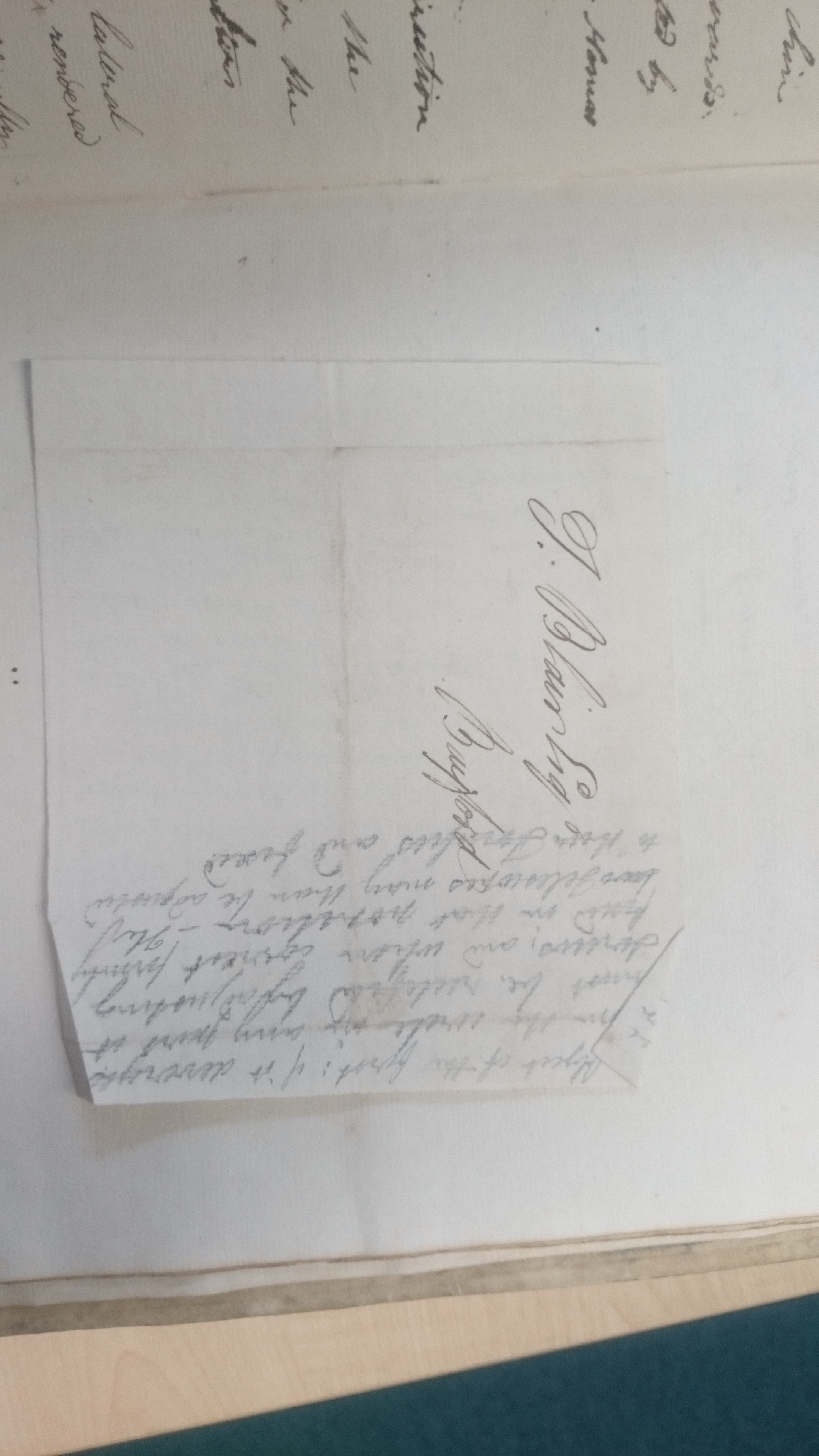
I decided to photograph the book to look into it further at home. As I did this I found a final clue about the author. Inside slipped between the back page and the cover a small piece of paper had been placed. It was a partially addressed envelope with the name J Blair esq on the front. I wondered if the B of AB could stand for the name Blair and if they had been in the process of writing to a relative.
The name of Blair was the breakthrough I needed. An Archibald Blair had lived in Bayford since 1799, after he had retired from the Bombay Marines. He had spent much of his life abroad. Employed as a surveyor he had mapped much of the coastline between Iraq, India and beyond. He had unfortunately spent a considerable time a prisoner of the French, for which he had been compensated on his release, with a large amount of money. During his survey missions he had surveyed the Anderman Islands and Port Blair is named after him. He had become the Andamans first administrator. He also had a brother named John whom had accompanied him into the Bombay Marines and then resided at Bayford with him.
On his return to the UK he had been elected as a fellow to the Royal Society with the letter of recommendation saying that
“Archibald Blair Esqr of Bayford, Herts, Captain on the Maritime Establishment of the East India Company at Bombay a Gentleman distinguished in his profession and for astronomical observations and having been employed by The East India Company in forming an Establishment at the Andamans “.
This gave me some idea of Archibald’s astronomical pedigree. And I knew at this stage I had found the author of the journal.
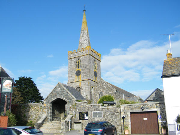
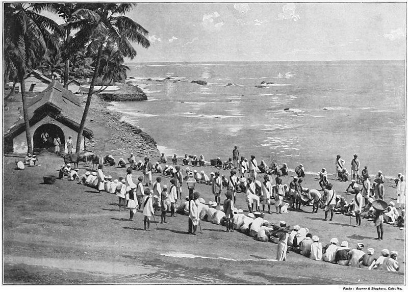
But how had the journal found itself into the local St Keverne parish records? After some further digging through the local Cornish records I was to discover in 1813 Archibald Bair had been recommended by the UK government and then appointed as head of the Porthleven Harbour Company. He was to design and build a harbour wall here in Cornwall creating a further harbour in the Mounts Bay area. It is very possible that he needed his design for a water pump with him and that his how his journal travelled the 330 miles from Bayford to West Cornwall. It was while residing at Treleven in 1815 just outside Porthleven that he unfortunately died. He was buried at the parish church in Sithney overlooking Porthleven harbour. It is only a short distance for the journal to travel from Porthleven to St Keverne with them being less than 15 miles apart.
Porthleven Harbour.
I feel a lot more of this man’s astronomical story is yet to be discovered maybe lying in archives around the world. After one of the reasons he had been elected to the Royal Society was for his astronomical observations. So if anyone has any more information about Archibald and his astronomical observations or his designs of telescopes and observatories I would be very keen to hear from you.